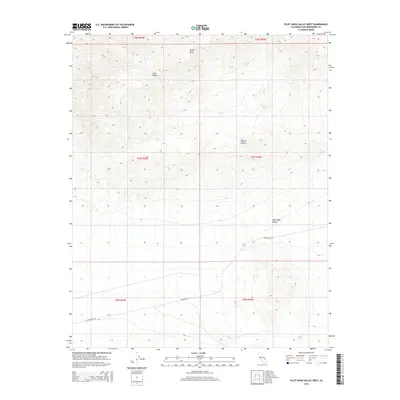
2015 Map of Pilot Knob Valley West
USGS Topo · Published 2015About this map
Straw Peak and the southern extent of the Slate Range dominate this high-desert landscape in northeastern San Bernardino County. The terrain is defined by dramatic elevation changes, where the peaks of the range transition sharply into the broad, alluvial expanse of Pilot Knob Valley to the south. This area is a remote sector of the Mojave Desert, characterized by its lack of permanent settlements or structures, which highlights the isolation and physical challenges of the region. The primary human imprint on the land is Randsburg Rd, which cuts across the southern portion of the sheet. This roadway serves as the principal artery through the arid valley floor, connecting the distant mining districts and desert outposts that define the history of this corner of California.
Find a feature on this map
11 named features on this map. Tap any name to fly to it.
Don’t see what you’re looking for? This feature index may not catch every label — zoom into the map to look around manually.
Map Details
Editions of this 2015 Pilot Knob Valley West Map
This is the sole edition of this map. No revisions or reprints were ever made.
Other maps of this area

1915 · Searles Lake
USGS Topo · 1:250,000

1947 · Trona
USGS Topo · 1:250,000

1948 · Trona
USGS Topo · 1:250,000

1949 · Searles Lake
USGS Topo · 1:62,500

1950 · Searles Lake
USGS Topo · 1:62,500

1950 · Wingate Pass
USGS Topo · 1:62,500

1951 · Wingate Pass
USGS Topo · 1:62,500

1953 · Trona
USGS Topo · 1:250,000

1954 · Pilot Knob
USGS Topo · 1:62,500

1954 · Cuddeback Lake
USGS Topo · 1:62,500