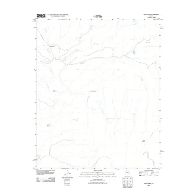
2011 Map of Pilot Knob
USGS Topo · Published 2011About this map
Francis Creek winds through a landscape of high mesas and deep drainages in this 2011 survey of Yavapai County. The area is defined by its water-management features, with numerous tanks such as Wikieup Tank, Rabbit Hollow Tank, and Steamboat Tank supporting land use across the Goodwin Mesa and Southeast Mesa highlands. Francis Creek Camp serves as a central point of activity along the creek, while the prominent peak of Pilot Knob rises above the Pilot Knob Basin in the northeast. This terrain is marked by several significant geological depressions, including Rag Canyon, Hawk Canyon, and Red Canyon, illustrating the erosional forces at work in this part of Arizona. Natural water sources like Devils Bathtub and Northwater Spring punctuate the arid landscape, while Trout Creek Rd and Francis Cr Rd provide limited access through the backcountry.
Find a feature on this map
28 named features on this map. Tap any name to fly to it.
Don’t see what you’re looking for? This feature index may not catch every label — zoom into the map to look around manually.
Map Details
Editions of this 2011 Pilot Knob Map
This is the sole edition of this map. No revisions or reprints were ever made.
Other maps of this area

1923 · Signal
USGS Topo · 1:250,000

1942 · Signal
USGS Topo · 1:250,000

1945 · Bagdad
USGS Topo · 1:62,500

1948 · Bagdad
USGS Topo · 1:62,500

1950 · Prescott
USGS Topo · 1:250,000

1954 · Prescott
USGS Topo · 1:250,000

1958 · Prescott
USGS Topo · 1:250,000

1959 · Prescott
USGS Topo · 1:250,000

1960 · Prescott
USGS Topo · 1:250,000

1965 · Prescott
USGS Topo · 1:250,000