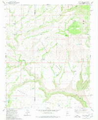
1980 Map of Pilot Knob
USGS Topo · Published 1980About this map
Old Cofer Hdqrs and Francis Creek Camp anchor this remote section of the high desert along the border of Mohave and Yavapai counties. The landscape is defined by massive plateau features, specifically Southeast Mesa and Goodwin Mesa, which are dissected by deep drainages like Francis Creek and Wikieup Canyon. This 1980 edition reveals a sparse but essential network of water sources necessary for ranching and survival in this environment, including numerous livestock tanks and natural springs such as Pilot Knob Spring and the curiously named Devils Bathtub.
Find a feature on this map
34 named features on this map. Tap any name to fly to it.
Don’t see what you’re looking for? This feature index may not catch every label — zoom into the map to look around manually.
Map Details
Editions of this 1980 Pilot Knob Map
This is the sole edition of this map. No revisions or reprints were ever made.
Other maps of this area

1923 · Signal
USGS Topo · 1:250,000

1942 · Signal
USGS Topo · 1:250,000

1945 · Bagdad
USGS Topo · 1:62,500

1948 · Bagdad
USGS Topo · 1:62,500

1950 · Prescott
USGS Topo · 1:250,000

1954 · Prescott
USGS Topo · 1:250,000

1958 · Prescott
USGS Topo · 1:250,000

1959 · Prescott
USGS Topo · 1:250,000

1960 · Prescott
USGS Topo · 1:250,000

1965 · Prescott
USGS Topo · 1:250,000