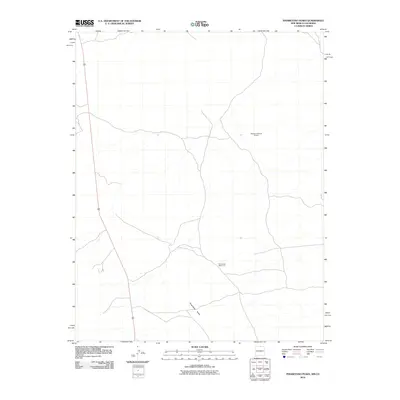
2010 Map of Pinabetoso Peaks
USGS Topo · Published 2010About this map
Pinabetoso Peaks anchor the southern landscape of this high-desert region in Rio Arriba County, where the infrastructure of wildlife management meets a remote transportation corridor. The map highlights specialized resource points such as the Maestas Antelope Guzzler and the Pina Game Water Unit, illustrating the modern efforts to support native species in an arid environment. Sliced by the long stretch of Highway 285, the area is defined by its sparse human footprint, prioritizing range management and natural land preservation over dense settlement. The topography revealed by the U.S. Geological Survey shows a network of seasonal watercourses and primitive roads that serve these isolated landmarks and cattle ranges near the Colorado border.
Find a feature on this map
4 named features on this map. Tap any name to fly to it.
Don’t see what you’re looking for? This feature index may not catch every label — zoom into the map to look around manually.
Map Details
Editions of this 2010 Pinabetoso Peaks Map
This is the sole edition of this map. No revisions or reprints were ever made.
Other maps of this area

1918 · Tusas
USGS Topo · 1:125,000

1922 · Conejos
USGS Topo · 1:125,000

1945 · Durango
USGS Topo · 1:250,000

1953 · Durango
USGS Topo · 1:250,000

1954 · Durango
USGS Topo · 1:250,000

1954 · Raton
USGS Topo · 1:250,000

1954 · Trinidad
USGS Topo · 1:250,000

1954 · Aztec
USGS Topo · 1:250,000

1955 · Trinidad
USGS Topo · 1:250,000

1958 · Raton
USGS Topo · 1:250,000