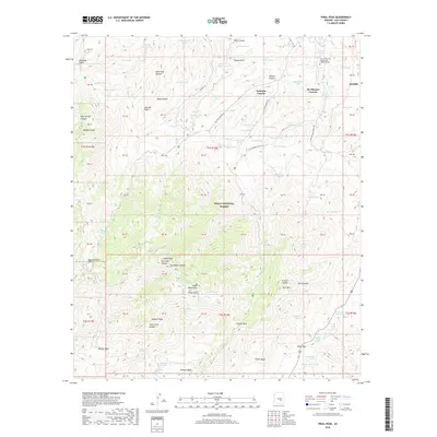
2018 Map of Pinal Peak
USGS Topo · Published 2018About this map
Pinal Peak dominates this high-elevation landscape within the Tonto National Forest, where the topography shifts from the southern edges of Globe into the dense drainages of the Pinal Mountains. The map reveals a complex system of canyon roads and water management features essential for the region, including Icehouse Canyon Rd and Kellner Canyon Rd. To the north, the Gila Community College Gila Pueblo Campus marks a point of academic activity on the outskirts of the mining district. The terrain is deeply carved by watercourses such as Six Shooter Canyon and Solitude Gulch, which are dotted with numerous catchment tanks like CCC One Tank and Schoolhouse Tank, reflecting the critical importance of water infrastructure in this arid environment.
Find a feature on this map
106 named features on this map. Tap any name to fly to it.
Don’t see what you’re looking for? This feature index may not catch every label — zoom into the map to look around manually.
Map Details
Editions of this 2018 Pinal Peak Map
This is the sole edition of this map. No revisions or reprints were ever made.
Other maps of this area

1901 · Globe
USGS Topo · 1:62,500

1902 · Globe
USGS Topo · 1:62,500

1910 · Ray
USGS Topo · 1:62,500

1915 · Christmas
USGS Topo · 1:62,500

1917 · Christmas
USGS Topo · 1:62,500

1945 · Globe
USGS Topo · 1:24,000

1945 · Inspiration
USGS Topo · 1:24,000

1947 · Inspiration
USGS Topo · 1:24,000

1948 · Pinal Ranch
USGS Topo · 1:24,000

1949 · Pinal Ranch
USGS Topo · 1:24,000