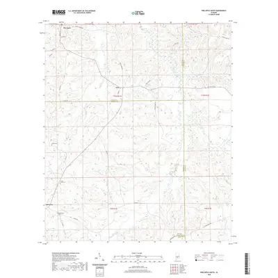
2020 Map of Pine Apple South
USGS Topo · Published 2020About this map
Pine Apple sits at the northern edge of this landscape, where the local road network branches out into the rural countryside of Wilcox and Monroe counties. The area is defined by the winding paths of Pine Barren Creek and Sturdivant Creek, which carve through the terrain and delineate the boundaries of several neighboring counties. Small settlements like Awin and Old Texas serve as local hubs, connected by routes such as Owens Rd and Co Rd 29.
Find a feature on this map
42 named features on this map. Tap any name to fly to it.
Don’t see what you’re looking for? This feature index may not catch every label — zoom into the map to look around manually.
Map Details
Editions of this 2020 Pine Apple South Map
This is the sole edition of this map. No revisions or reprints were ever made.
Other maps of this area

1953 · Andalusia
USGS Topo · 1:250,000

1957 · Andalusia
USGS Topo · 1:250,000

1971 · Skinnerton
USGS Topo · 1:24,000

1971 · Bethel
USGS Topo · 1:24,000

1971 · Georgiana West
USGS Topo · 1:24,000
1981 · Oak Hill
USGS Topo · 1:24,000

1981 · Pine Apple North
USGS Topo · 1:24,000

1981 · Forest Home
USGS Topo · 1:24,000
1981 · Mc Williams
USGS Topo · 1:24,000
1981 · Ridgeville
USGS Topo · 1:24,000