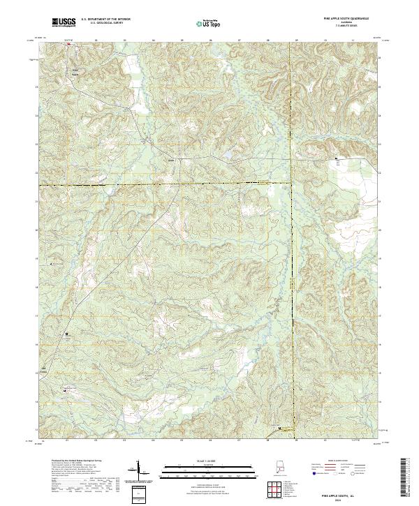
2024 Map of Pine Apple South
USGS Topo · Published 2024About this map
Pine Apple and the smaller settlements of Awin and Old Texas anchor this landscape where the borders of Monroe, Wilcox, Butler, and Conecuh counties converge. The topography is defined by a dense network of watercourses, including Turkey Creek, Pine Barren Creek, and Sturdivant Creek, which carve through the terrain between rural road segments like Co Rd 29 and Owens Rd. For those researching local history, the map provides a specific record of rural burial sites, noting the Jenkins Chapel Cem, Bethlehem Cem, and Solomon Cem. The convergence of multiple county lines and the distribution of these small cemeteries suggest a long-established pattern of dispersed family farms and community centers that remain central to the geography of southern Alabama.
Find a feature on this map
41 named features on this map. Tap any name to fly to it.
Don’t see what you’re looking for? This feature index may not catch every label — zoom into the map to look around manually.
Map Details
Editions of this 2024 Pine Apple South Map
This is the sole edition of this map. No revisions or reprints were ever made.
Other maps of this area

1953 · Andalusia
USGS Topo · 1:250,000

1957 · Andalusia
USGS Topo · 1:250,000

1971 · Skinnerton
USGS Topo · 1:24,000

1971 · Bethel
USGS Topo · 1:24,000

1971 · Georgiana West
USGS Topo · 1:24,000
1981 · Oak Hill
USGS Topo · 1:24,000

1981 · Pine Apple North
USGS Topo · 1:24,000

1981 · Forest Home
USGS Topo · 1:24,000
1981 · Mc Williams
USGS Topo · 1:24,000
1981 · Ridgeville
USGS Topo · 1:24,000