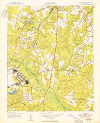
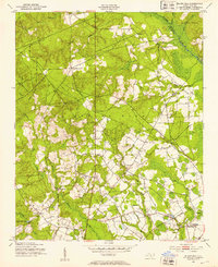
1950 Map of Pine Bluff
USGS Topo · Published 1950About this map
Camp Mackall Military Reservation dominates the southwestern portion of this landscape, established just years prior during World War II as a major airborne training center. The terrain transitions from the developed settlement of Pine Bluff and Lincoln Park in the north toward the swampy lowlands of the Sand Hills and Quewhiffle Creek. This postwar era survey reveals a region shaped by both military expansion and the longstanding Seaboard Air Line railroad, which supported local industries like the Ice Loading Platform near Aberdeen Creek.
Find a feature on this map
39 named features on this map. Tap any name to fly to it.
Don’t see what you’re looking for? This feature index may not catch every label — zoom into the map to look around manually.
Map Details
Editions of this 1950 Pine Bluff Map
This is the sole edition of this map. No revisions or reprints were ever made.
Other maps of this area

1942 · Troy
USGS Topo · 1:125,000

1942 · Rockingham
USGS Topo · 1:125,000

1948 · Southern Pines
USGS Topo · 1:62,500
1948 · Pinebluff
USGS Topo · 1:24,000
1948 · Mc Cain
USGS Topo · 1:24,000
1949 · Wagram
USGS Topo · 1:24,000
1949 · Silver Hill
USGS Topo · 1:24,000
1949 · West End
USGS Topo · 1:24,000
1949 · Hoffman
USGS Topo · 1:24,000
1949 · Marston
USGS Topo · 1:24,000