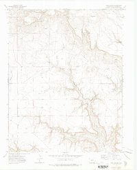
1972 Map of Pine Canyon
USGS Topo · Published 1975About this map
Pine Canyon and its network of side drainages dominate this 1970s topographical record of the Colorado high plains. The landscape is defined by its water sources and deep incisions, where family-named landmarks like John Hart Spring and Wilson Spring suggest the critical importance of reliable water in this arid environment. The map details a complex system of canyons including Schoolhouse Canyon, Pacheco Canyon, and the prominent Cow Canyon which snakes through the eastern half of the quadrangle. High points like Hardesty Mesa and The Corona provide orientation above the winding drainage systems, while the presence of a Jeep Trail indicates the limited, specialized access to these remote areas. Geologic and topographic features such as The Narrows and Salazar Rincon underscore the varied terrain that has historically shaped movement and land use in Las Animas County.
Find a feature on this map
21 named features on this map. Tap any name to fly to it.
Don’t see what you’re looking for? This feature index may not catch every label — zoom into the map to look around manually.
Map Details
Editions of this 1972 Pine Canyon Map
This is the sole edition of this map. No revisions or reprints were ever made.
Other maps of this area

1891 · Mesa De Maya
USGS Topo · 1:125,000

1893 · Mesa de Maya
USGS Topo · 1:125,000

1954 · Dalhart
USGS Topo · 1:250,000

1955 · La Junta
USGS Topo · 1:250,000

1958 · La Junta
USGS Topo · 1:250,000

1958 · Dalhart
USGS Topo · 1:250,000

1962 · Dalhart
USGS Topo · 1:250,000

1968 · La Junta
USGS Topo · 1:250,000
1972 · Branson SE
USGS Topo · 1:24,000

1972 · Emery Peak
USGS Topo · 1:24,000