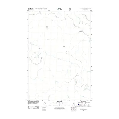
2011 Map of Pine Creek Ridge
USGS Topo · Published 2011About this map
Stormy Peak Lookout stands as a prominent high-point marker in this corner of the Salmon-Challis National Forest, overlooking the drainage systems of Lemhi County. The landscape is defined by the high spine of Pine Creek Ridge and the deep incisions of Virginia Gulch and Arrastra Gulch, the latter name hinting at early mechanical mining history in the region. A network of Forest Service roads, including the China Gulch Rd and Nat For Dev Rd 435, provides access to the high-country meadows like East Boulder Meadow. The map detail follows the convergence of several waterways, such as Beaver Creek, Arnett Creek, and Moose Creek, which carve through the terrain beneath Haystack Mountain. This topography illustrates the complex hydrology of the Idaho mountains as it was documented in the early 21st century.
Find a feature on this map
21 named features on this map. Tap any name to fly to it.
Don’t see what you’re looking for? This feature index may not catch every label — zoom into the map to look around manually.
Map Details
Editions of this 2011 Pine Creek Ridge Map
This is the sole edition of this map. No revisions or reprints were ever made.
Other maps of this area

1950 · Blackbird Mtn
USGS Topo · 1:62,500

1950 · Leesburg
USGS Topo · 1:62,500

1951 · Leesburg
USGS Topo · 1:62,500

1951 · Blackbird Mtn
USGS Topo · 1:62,500

1956 · Elk City
USGS Topo · 1:250,000

1960 · Elk City
USGS Topo · 1:250,000

1960 · Ulysses Mtn
USGS Topo · 1:62,500

1960 · Shoup
USGS Topo · 1:62,500

1982 · Bighorn Crags
USGS Topo · 1:100,000
1989 · Leesburg
USGS Topo · 1:24,000