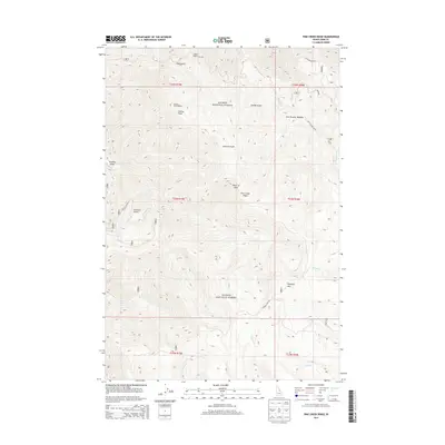
2013 Map of Pine Creek Ridge
USGS Topo · Published 2013About this map
Salmon National Forest dominates this high-elevation terrain in Lemhi County, defined by the prominent central spine of Pine Creek Ridge. The map details a complex network of drainages and peaks, including Stormy Peak and its associated Stormy Peak Lookout, as well as Haystack Mtn to the southeast. The landscape is deeply incised by gulches such as Hale Gulch, Sawlog Gulch, and the mining-referenced Arrastra Gulch.
Find a feature on this map
31 named features on this map. Tap any name to fly to it.
Don’t see what you’re looking for? This feature index may not catch every label — zoom into the map to look around manually.
Map Details
Editions of this 2013 Pine Creek Ridge Map
This is the sole edition of this map. No revisions or reprints were ever made.
Other maps of this area

1950 · Blackbird Mtn
USGS Topo · 1:62,500

1950 · Leesburg
USGS Topo · 1:62,500

1951 · Leesburg
USGS Topo · 1:62,500

1951 · Blackbird Mtn
USGS Topo · 1:62,500

1956 · Elk City
USGS Topo · 1:250,000

1960 · Elk City
USGS Topo · 1:250,000

1960 · Ulysses Mtn
USGS Topo · 1:62,500

1960 · Shoup
USGS Topo · 1:62,500

1982 · Bighorn Crags
USGS Topo · 1:100,000
1989 · Leesburg
USGS Topo · 1:24,000