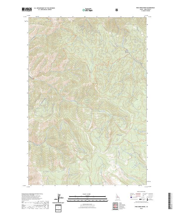
2024 Map of Pine Creek Ridge
USGS Topo · Published 2024About this map
Salmon National Forest encompasses the high terrain of Lemhi County, Idaho, where the prominent Pine Creek Ridge divides numerous drainages. This high-altitude landscape is defined by its network of watercourses, including Pine Creek, Beaver Creek, and Moose Creek, which carve through the land between landmarks like Stormy Peak and Haystack Mtn. The map reveals a land managed for its natural resources and recreational access, characterized by various forest development roads and primitive pathways.
Find a feature on this map
38 named features on this map. Tap any name to fly to it.
Don’t see what you’re looking for? This feature index may not catch every label — zoom into the map to look around manually.
Map Details
Editions of this 2024 Pine Creek Ridge Map
This is the sole edition of this map. No revisions or reprints were ever made.
Other maps of this area

1950 · Blackbird Mtn
USGS Topo · 1:62,500

1950 · Leesburg
USGS Topo · 1:62,500

1951 · Leesburg
USGS Topo · 1:62,500

1951 · Blackbird Mtn
USGS Topo · 1:62,500

1956 · Elk City
USGS Topo · 1:250,000

1960 · Elk City
USGS Topo · 1:250,000

1960 · Ulysses Mtn
USGS Topo · 1:62,500

1960 · Shoup
USGS Topo · 1:62,500

1982 · Bighorn Crags
USGS Topo · 1:100,000
1989 · Leesburg
USGS Topo · 1:24,000