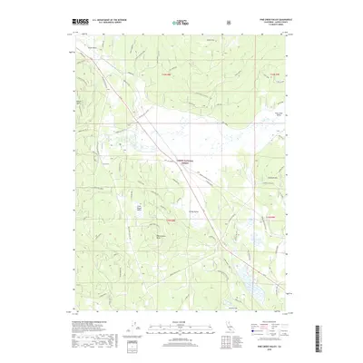
2018 Map of Pine Creek Valley
USGS Topo · Published 2018About this map
Lassen National Forest terrain dominates this high-altitude landscape, where volcanic peaks and seasonally fluctuating wetlands define the local geography. High points like Crater Mtn and Bogard Buttes overlook a series of volcanic flats and valleys, including Grays Valley and Little Round Valley. The hydrography of the region is centered on volcanic basin lakes such as Feather Lake and Long Lake, which feed into the headwaters of the Susan River near Norvell Flat.
Find a feature on this map
68 named features on this map. Tap any name to fly to it.
Don’t see what you’re looking for? This feature index may not catch every label — zoom into the map to look around manually.
Map Details
Editions of this 2018 Pine Creek Valley Map
This is the sole edition of this map. No revisions or reprints were ever made.
Other maps of this area

1886 · Honey Lake
USGS Topo · 1:250,000

1886 · Lassen Peak
USGS Topo · 1:250,000

1891 · Honey Lake
USGS Topo · 1:250,000

1892 · Lassen Peak
USGS Topo · 1:250,000

1893 · Honey Lake
USGS Topo · 1:250,000

1894 · Lassen Peak
USGS Topo · 1:250,000

1939 · Halls Flat
USGS Topo · 1:125,000

1955 · Westwood
USGS Topo · 1:62,500

1955 · Westwood
USGS Topo · 1:250,000

1956 · Chester
USGS Topo · 1:62,500