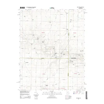
2015 Map of Pine Crest
USGS Topo · Published 2015About this map
Mountain View anchor's the southern edge of this landscape, where the Ozark Plateau begins its descent toward the river corridors of the Ozark National Scenic Riverways. The terrain is defined by a dense network of hollows, such as Tracy Hollow and Buckhorn Hollow, which drain into the North Prong Jacks Fork and the Jacks Fork. These watercourses were historically vital for transit, evidenced by named crossings like Harlow Ford and Ratcliff Ford. Smaller settlements and communities including Arroll, Oakside, and Pine Crest are scattered throughout, often centered around family or church burial grounds like Cold Spring Cemetery and Oakside Cemetery. The area reveals a pattern of dispersed rural living, with isolated features like Chimney Rock and Baptizing Hole serving as local landmarks. The convergence of Texas Co, Shannon Co, and Howell Co borders within this sheet highlights the historical importance of this area as a crossroads for the region.
Find a feature on this map
95 named features on this map. Tap any name to fly to it.
Don’t see what you’re looking for? This feature index may not catch every label — zoom into the map to look around manually.
Map Details
Editions of this 2015 Pine Crest Map
This is the sole edition of this map. No revisions or reprints were ever made.
Other maps of this area

1945 · Willow Springs
USGS Topo · 1:62,500

1945 · Montier
USGS Topo · 1:62,500

1945 · Clear Springs
USGS Topo · 1:62,500

1946 · Summersville
USGS Topo · 1:62,500

1948 · Clear Springs
USGS Topo · 1:62,500

1948 · Montier
USGS Topo · 1:62,500

1948 · Willow Springs
USGS Topo · 1:62,500

1948 · Summersville
USGS Topo · 1:62,500

1949 · Rolla
USGS Topo · 1:250,000

1953 · Rolla
USGS Topo · 1:250,000