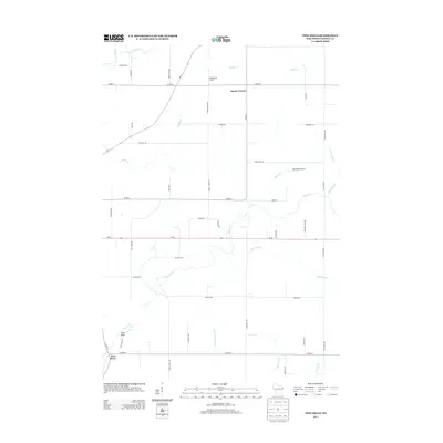
2013 Map of Pine Dells
USGS Topo · Published 2013About this map
The Pine River and its various tributaries define the rural landscape of Lincoln County in this 2013 survey. The settlement of Pine Dells sits in the southwestern corner, while the crossroads of Dutch Corners occupies a more central position north of the main river valley. This part of Wisconsin maintains a sparse residential pattern, punctuated by local aviation facilities like Podeweltz Airport and Pine River Airport. The hydrography of the region is notably dense, featuring the Prairie River in the north and a network of smaller streams including Pat Smith Cr, Barnes Cr, and the Little Trappe River. The infrastructure is dominated by state routes Wi-64 and Wi-17, which connect these small rural communities and agricultural lands. The map details a transition from the larger river valleys to the smaller drainages of Little Cain Cr and Big Cain Cr in the south.
Find a feature on this map
47 named features on this map. Tap any name to fly to it.
Don’t see what you’re looking for? This feature index may not catch every label — zoom into the map to look around manually.
Map Details
Editions of this 2013 Pine Dells Map
This is the sole edition of this map. No revisions or reprints were ever made.
Other maps of this area

1899 · Wausau
USGS Topo · 1:125,000

1902 · Wausau
USGS Topo · 1:125,000

1940 · Parrish
USGS Topo · 1:48,000

1950 · Parrish
USGS Topo · 1:48,000

1950 · Tomahawk
USGS Topo · 1:48,000

1951 · Doering
USGS Topo · 1:48,000

1951 · Merrill
USGS Topo · 1:48,000

1952 · Parrish
USGS Topo · 1:48,000

1952 · Tomahawk
USGS Topo · 1:48,000

1954 · Iron Mountain
USGS Topo · 1:250,000