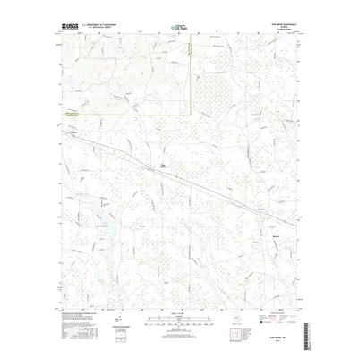
2017 Map of Pine Grove
USGS Topo · Published 2017About this map
Baxley and the surrounding pine-rich lowlands of southeast Georgia are documented here in 2017, showing a landscape defined by traditional agriculture and intricate drainage systems. The survey details the northwestern expansion of Baxley, including the Baxley Cemetery and the transition into more rural settlements such as Prentiss and Pine Grove. Further west, the town of Graham sits along the Jeff Davis County and Appling County line, connected by a network of timber and farm roads like Sellers Road and Nails Ferry Road. The area's water-managed geography is evident through features like Miller Lake, Big Pond, and the meandering Black Water Creek. Genealogists will find several small family or community burial grounds, including Sellers Cemetery and Crapps Cemetery, which anchor the local history of these dispersed rural communities.
Find a feature on this map
96 named features on this map. Tap any name to fly to it.
Don’t see what you’re looking for? This feature index may not catch every label — zoom into the map to look around manually.
Map Details
Editions of this 2017 Pine Grove Map
This is the sole edition of this map. No revisions or reprints were ever made.
Other maps of this area

1953 · Waycross
USGS Topo · 1:250,000

1958 · Waycross
USGS Topo · 1:250,000

1970 · Baxley NE
USGS Topo · 1:24,000

1970 · Pine Grove
USGS Topo · 1:24,000
1970 · Grays Landing
USGS Topo · 1:24,000

1970 · Baxley
USGS Topo · 1:24,000

1971 · Nicholls NE
USGS Topo · 1:24,000
1971 · Hazlehurst North
USGS Topo · 1:24,000

1971 · Alma NW
USGS Topo · 1:24,000

1971 · Hazlehurst South
USGS Topo · 1:24,000