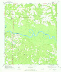
1970 Map of Baxley NE
USGS Topo · Published 1974About this map
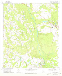
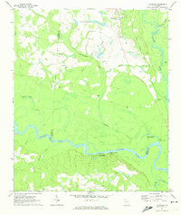
The Altamaha River meanders through this South Georgia landscape, serving as the primary geographic divide between Toombs and Appling counties. Along its northern banks, the settlement of English Eddy appears as a focal point of local history, flanked by the English Eddy Ch and nearby Taylor Chapel. The interior terrain is defined by a network of seasonal drainages including Cobb Creek and Bells Mill Creek, with numerous family and community landmarks such as Smith Cem, Moody Cem, and Old Campground Cem scattered throughout the pine-heavy lowlands. Industrial modernization is evident near the river's edge, where a large Powerplant and associated Radio Tower installations stand in contrast to older rural landmarks like Falling Rocks. The map also documents the era's infrastructure with an Industrial road and a prominent Pipeline cutting through the southern timberlands near Davis.
Find a feature on this map
37 named features on this map. Tap any name to fly to it.
Don’t see what you’re looking for? This feature index may not catch every label — zoom into the map to look around manually.
Map Details
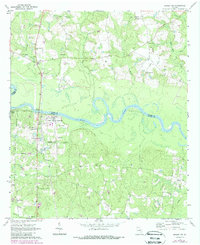
Editions of this 1970 Baxley NE Map
2 editions found
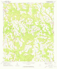
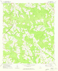
Other maps of this area

1953 · Waycross
USGS Topo · 1:250,000

1957 · Macon
USGS Topo · 1:250,000

1958 · Macon
USGS Topo · 1:250,000

1958 · Waycross
USGS Topo · 1:250,000

1964 · Macon
USGS Topo · 1:250,000
1970 · Johnson Corner
USGS Topo · 1:24,000
1970 · Alston
USGS Topo · 1:24,000
1970 · Reidsville West
USGS Topo · 1:24,000
1970 · Altamaha
USGS Topo · 1:24,000
1970 · Altamaha SW
USGS Topo · 1:24,000