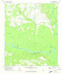
1970 Map of Altamaha
USGS Topo · Published 1974About this map
The Altamaha River winds through this coastal plain landscape where Tattnall, Toombs, and Appling counties meet. This 1970 survey documents a transition between organized institutional land and rural riverfront settlements, notably marked by the State Prison complex and its associated State Prison Cem in the north. The small community of Altamaha sits inland from the river bluffs, while the river itself features critical access points like Davis Landing and a Boat Landing near Tippens Lakes. Geologic and industrial interests are represented by Iron Mine Bluff overlooking the river near Eason Bluff. Numerous family and community landmarks, such as Widincamp Cem and Pearson Chapel, are scattered throughout the pine-heavy terrain, connected by a network of drainage systems including Slaughter Creek and the Ohoopee River.
Find a feature on this map
35 named features on this map. Tap any name to fly to it.
Don’t see what you’re looking for? This feature index may not catch every label — zoom into the map to look around manually.
Map Details
Editions of this 1970 Altamaha Map
This is the sole edition of this map. No revisions or reprints were ever made.
Other maps of this area

1953 · Waycross
USGS Topo · 1:250,000

1957 · Macon
USGS Topo · 1:250,000

1958 · Macon
USGS Topo · 1:250,000

1958 · Waycross
USGS Topo · 1:250,000

1964 · Macon
USGS Topo · 1:250,000

1970 · Johnson Corner
USGS Topo · 1:24,000

1970 · Reidsville West
USGS Topo · 1:24,000
1970 · Reidsville East
USGS Topo · 1:24,000

1970 · Baxley NE
USGS Topo · 1:24,000
1970 · Altamaha SE
USGS Topo · 1:24,000