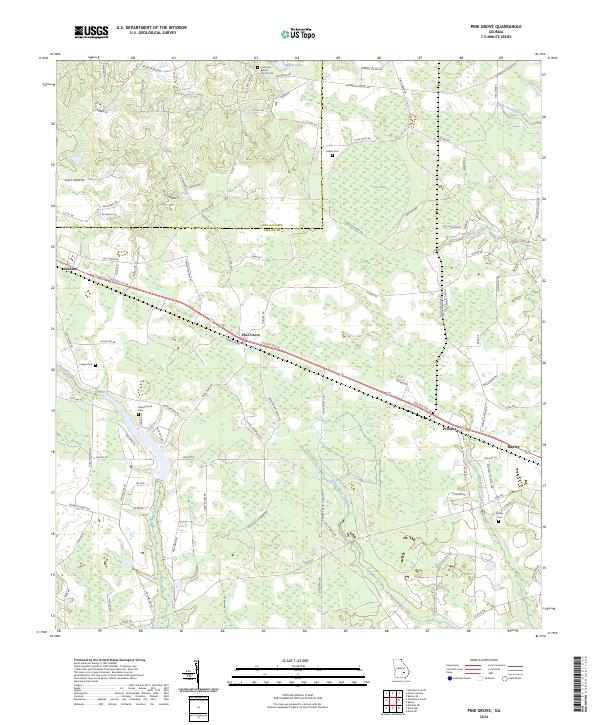
2024 Map of Pine Grove
USGS Topo · Published 2024About this map
The boundary between Jeff Davis and Appling Counties cuts across this landscape, which is defined by a dense network of creeks and wetlands feeding into the Altamaha River basin. Settlement centers on Graham, Pine Grove, and Prentiss, clustered along the Golden Isle West highway corridor as it approaches the city of Baxley. The rural character of the area is underscored by numerous small family and community burial grounds, including Sellers Cem, Crapps Cem, and the Oak View Baptist Church Cem. A complex drainage system of blackwater streams, such as Black Water Creek and Tenmile Creek, winds through the pine-dominated terrain. To the north, Big Pond and Miller Lake stand as significant water features, while the southern reaches are marked by the headwaters of Sweetwater Creek and Bishop Creek.
Find a feature on this map
98 named features on this map. Tap any name to fly to it.
Don’t see what you’re looking for? This feature index may not catch every label — zoom into the map to look around manually.
Map Details
Editions of this 2024 Pine Grove Map
This is the sole edition of this map. No revisions or reprints were ever made.
Other maps of this area

1953 · Waycross
USGS Topo · 1:250,000

1958 · Waycross
USGS Topo · 1:250,000

1970 · Baxley NE
USGS Topo · 1:24,000

1970 · Pine Grove
USGS Topo · 1:24,000
1970 · Grays Landing
USGS Topo · 1:24,000

1970 · Baxley
USGS Topo · 1:24,000

1971 · Nicholls NE
USGS Topo · 1:24,000
1971 · Hazlehurst North
USGS Topo · 1:24,000

1971 · Alma NW
USGS Topo · 1:24,000

1971 · Hazlehurst South
USGS Topo · 1:24,000