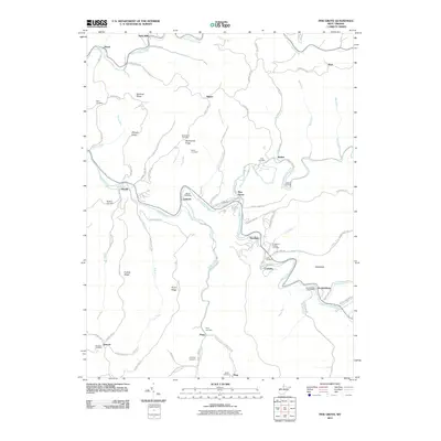
2011 Map of Pine Grove
USGS Topo · Published 2011About this map
Pine Grove serves as the central hub of this Wetzel County landscape, where the North Fork Fishing Creek and South Fork Fishing Creek converge. The topography is defined by high ridgelines and the winding valleys of Fishing Creek, creating a distinct pattern of settlement that clings to the narrow floodplains. To the southeast, the village of Jacksonburg is noted by the Jacksonburg Post Office, marking its importance as a local community center.
Find a feature on this map
86 named features on this map. Tap any name to fly to it.
Don’t see what you’re looking for? This feature index may not catch every label — zoom into the map to look around manually.
Map Details
Editions of this 2011 Pine Grove Map
This is the sole edition of this map. No revisions or reprints were ever made.
Other maps of this area

1903 · Littleton
USGS Topo · 1:62,500

1905 · Centerpoint
USGS Topo · 1:62,500

1905 · West Union
USGS Topo · 1:62,500

1905 · Littleton
USGS Topo · 1:62,500

1906 · New Martinsville
USGS Topo · 1:62,500

1924 · New Martinsville
USGS Topo · 1:62,500

1924 · Centerpoint
USGS Topo · 1:62,500

1924 · Littleton
USGS Topo · 1:62,500

1924 · West Union
USGS Topo · 1:62,500

1925 · Centerpoint
USGS Topo · 1:62,500