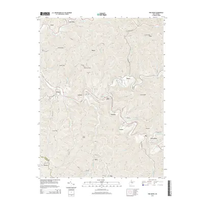
2014 Map of Pine Grove
USGS Topo · Published 2014About this map
Pine Grove and the neighboring settlements of Jacksonburg and Reader sit within the complex topography of Wetzel County, where the North Fork Fishing Creek and South Fork Fishing Creek converge. The landscape is defined by a series of narrow valleys and prominent high points such as Ashland Ridge and Creswell Ridge, which historically dictated the placement of homesteads and small communities. These ridges separate numerous small drainages like Wyatt Run and Barker Run, creating a highly fractured terrain where transportation routes were forced to follow the winding watercourses.
Find a feature on this map
92 named features on this map. Tap any name to fly to it.
Don’t see what you’re looking for? This feature index may not catch every label — zoom into the map to look around manually.
Map Details
Editions of this 2014 Pine Grove Map
This is the sole edition of this map. No revisions or reprints were ever made.
Other maps of this area

1903 · Littleton
USGS Topo · 1:62,500

1905 · Centerpoint
USGS Topo · 1:62,500

1905 · West Union
USGS Topo · 1:62,500

1905 · Littleton
USGS Topo · 1:62,500

1906 · New Martinsville
USGS Topo · 1:62,500

1924 · New Martinsville
USGS Topo · 1:62,500

1924 · Centerpoint
USGS Topo · 1:62,500

1924 · Littleton
USGS Topo · 1:62,500

1924 · West Union
USGS Topo · 1:62,500

1925 · Centerpoint
USGS Topo · 1:62,500