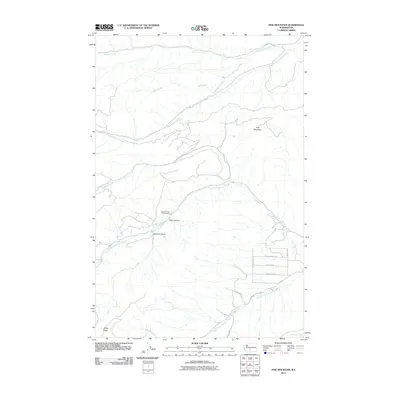
2011 Map of Pine Mountain
USGS Topo · Published 2011About this map
Pine Mountain and the surrounding drainage basins define this central Washington landscape as it was documented in 2011. The terrain is characterized by deep incisions and high ridges, notably Sedge Ridge to the southwest and Bear Canyon near the center of the sheet. The hydrological network is dense, with the North Fork Ahtanum Creek and South Fork Ahtanum Creek converging toward the east. This area serves as a significant recreational and resource corridor, anchored by the Soda Springs Forest Camp. Local access is provided by a network of specialized routes such as Cowiche Mill Rd and Nasty Creek Rd, while the eastern portion of the map shows a shift toward more modern residential development with streets like Canyon Crest Rd and Culdron Dr.
Find a feature on this map
22 named features on this map. Tap any name to fly to it.
Don’t see what you’re looking for? This feature index may not catch every label — zoom into the map to look around manually.
Map Details
Editions of this 2011 Pine Mountain Map
This is the sole edition of this map. No revisions or reprints were ever made.
Other maps of this area

1899 · Ellensburg
USGS Topo · 1:125,000

1901 · Ellensburg
USGS Topo · 1:125,000

1902 · Mount Aix
USGS Topo · 1:125,000

1904 · Mt Aix
USGS Topo · 1:125,000

1904 · Mount Adams
USGS Topo · 1:125,000

1907 · Mount Adams
USGS Topo · 1:125,000

1937 · White Swan
USGS Topo · 1:125,000

1950 · Yakima
USGS Topo · 1:250,000

1957 · Yesmowit Canyon
USGS Topo · 1:24,000

1958 · Fort Simcoe
USGS Topo · 1:62,500