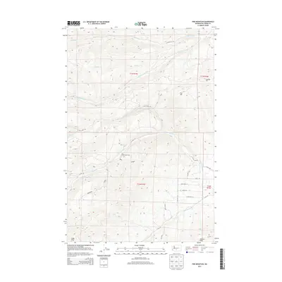
2014 Map of Pine Mountain
USGS Topo · Published 2014About this map
Soda Springs Forest Camp sits at the heart of this Yakima County landscape, marking a junction of mountain terrain and forest access. The area is defined by a series of parallel ridges and deep drainages, including the prominent Pine Mtn and Cowiche Mtn. These peaks divide the water flow between the S Fork Cowiche Cr to the north and the N Fork Ahtanum Cr system to the south. This network of creeks carving through Bear Canyon and Carpenter Gulch created a challenging environment for early transit, reflected in the winding paths of Nasty Creek Rd and Cowiche Mill Rd.
Find a feature on this map
31 named features on this map. Tap any name to fly to it.
Don’t see what you’re looking for? This feature index may not catch every label — zoom into the map to look around manually.
Map Details
Editions of this 2014 Pine Mountain Map
This is the sole edition of this map. No revisions or reprints were ever made.
Other maps of this area

1899 · Ellensburg
USGS Topo · 1:125,000

1901 · Ellensburg
USGS Topo · 1:125,000

1902 · Mount Aix
USGS Topo · 1:125,000

1904 · Mt Aix
USGS Topo · 1:125,000

1904 · Mount Adams
USGS Topo · 1:125,000

1907 · Mount Adams
USGS Topo · 1:125,000

1937 · White Swan
USGS Topo · 1:125,000

1950 · Yakima
USGS Topo · 1:250,000

1957 · Yesmowit Canyon
USGS Topo · 1:24,000

1958 · Fort Simcoe
USGS Topo · 1:62,500