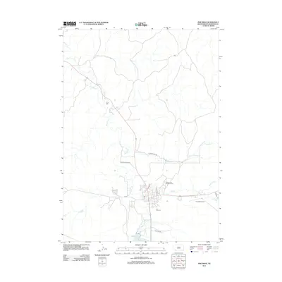
2012 Map of Pine Ridge
USGS Topo · Published 2012About this map
White Clay Cr snakes through the landscape, anchoring the settlement patterns of this Oglala Lakota County region in 2012. The local infrastructure reflects a mix of civic and cultural priorities, from the Oglala-Sioux Sundance Arena to the Pine Ridge Airport. The road network, including the distinctively named Trash Pile Rd and Merrival Buffalo Rd, connects the central community to outlying areas near Wolf Creek Lake. Genealogists and local historians can locate the Holy Cross Cem south of the primary town cluster, while natural features like White Clay Lake and Cheyenne Cr define the surrounding plains. The map provides a clear view of how water sources and modern tribal facilities interact within this specific corner of South Dakota.
Find a feature on this map
17 named features on this map. Tap any name to fly to it.
Don’t see what you’re looking for? This feature index may not catch every label — zoom into the map to look around manually.
Map Details
Editions of this 2012 Pine Ridge Map
This is the sole edition of this map. No revisions or reprints were ever made.
Other maps of this area

1955 · Hot Springs
USGS Topo · 1:250,000

1955 · Alliance
USGS Topo · 1:250,000

1957 · Alliance
USGS Topo · 1:250,000

1958 · Alliance
USGS Topo · 1:250,000

1967 · Pine Ridge SW
USGS Topo · 1:24,000

1967 · Pine Ridge NE
USGS Topo · 1:24,000

1967 · Pine Ridge
USGS Topo · 1:24,000

1967 · Manderson
USGS Topo · 1:24,000

1967 · Oglala
USGS Topo · 1:24,000

1967 · Manderson SW
USGS Topo · 1:24,000