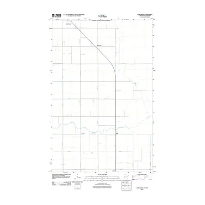
2010 Map of Pinecreek
USGS Topo · Published 2010About this map
The Canada - United States Boundary defines the northern edge of this remote northern Minnesota landscape, where the international line cuts directly through the Piney Pinecreek Border Airport. This unique aviation facility serves the small settlement of Pinecreek, situated at a geographic crossroads just south of the border. The terrain is characterized by a precise grid of rural roads and drainage projects like County Ditch Number Seventeen, reflecting a highly organized approach to managing the low-lying plains of Roseau County. To the south, the meandering Roseau River provides a natural contrast to the straight section lines, passing near the community of Ross. Local history is anchored by the Concordia Cemetery and Mellum Cemetery, which stand as enduring markers of the families who settled this borderland region.
Find a feature on this map
24 named features on this map. Tap any name to fly to it.
Don’t see what you’re looking for? This feature index may not catch every label — zoom into the map to look around manually.
Map Details
Editions of this 2010 Pinecreek Map
This is the sole edition of this map. No revisions or reprints were ever made.
Other maps of this area

1918 · Roseau
USGS Topo · 1:62,500

1919 · Badger
USGS Topo · 1:62,500

1952 · Thief River Falls
USGS Topo · 1:250,000

1954 · Roseau
USGS Topo · 1:250,000

1956 · Thief River Falls
USGS Topo · 1:250,000

1957 · Roseau
USGS Topo · 1:250,000

1957 · Thief River Falls
USGS Topo · 1:250,000

1958 · Roseau
USGS Topo · 1:250,000

1963 · Kenora
USGS Topo · 1:250,000
1966 · Pinecreek
USGS Topo · 1:24,000