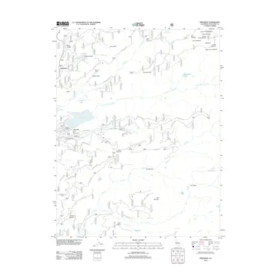
2012 Map of Pinecrest
USGS Topo · Published 2012About this map
Pinecrest Lake and the N Fork Tuolumne River anchor this high-elevation landscape in Tuolumne County, reflecting a mid-century character defined by seasonal recreation and forestry management. The settlement of Pinecrest serves as a central hub, surrounded by a dense network of organized sites including the California Alumni Camp, Camp Stephens, and Camp Chinquapin. This concentration of institutional camps alongside the Dodge Ridge Ski Area highlights the area's transition from traditional mountain use to a premier recreational destination.
Find a feature on this map
66 named features on this map. Tap any name to fly to it.
Don’t see what you’re looking for? This feature index may not catch every label — zoom into the map to look around manually.
Map Details
Editions of this 2012 Pinecrest Map
This is the sole edition of this map. No revisions or reprints were ever made.
Other maps of this area

1891 · Big Trees
USGS Topo · 1:125,000

1894 · Big Trees
USGS Topo · 1:125,000

1896 · Dardanelles
USGS Topo · 1:125,000

1897 · Big Trees
USGS Topo · 1:125,000

1898 · Dardanelles
USGS Topo · 1:125,000

1901 · Big Trees
USGS Topo · 1:125,000

1947 · Sacramento
USGS Topo · 1:250,000

1948 · Walker Lake
USGS Topo · 1:250,000

1948 · Sacramento
USGS Topo · 1:250,000

1956 · Sacramento
USGS Topo · 1:250,000