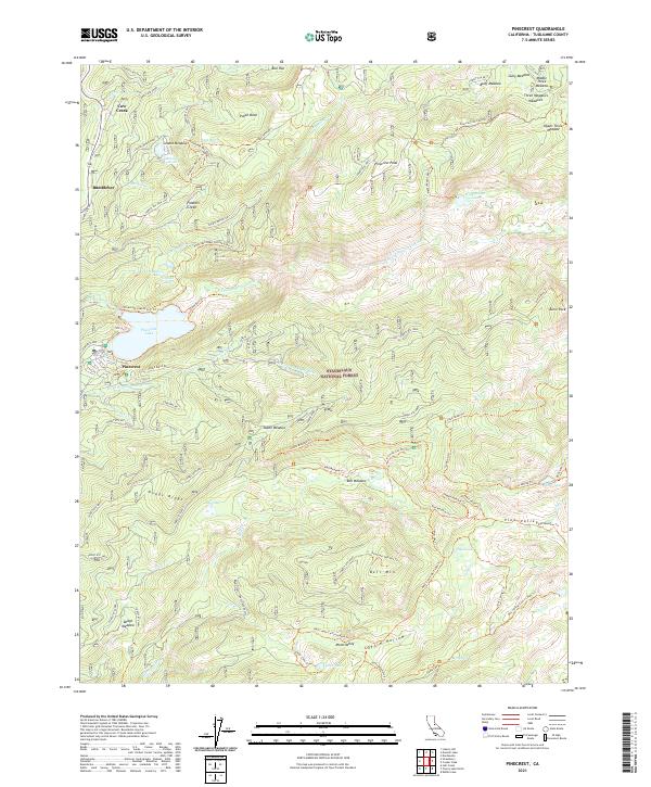
2021 Map of Pinecrest
USGS Topo · Published 2021About this map
Pinecrest and the surrounding high Sierra landscape of the Stanislaus National Forest are defined by an intricate network of waterways and glacial features. The S Fork Stanislaus River and the N Fork Tuolumne River serve as primary drainage systems, while the presence of Leland Reservoir and the well-known Pinecrest Lake highlights the region's managed water resources. To the south, the terrain rises toward Dodge Ridge, a significant geographic marker for recreation and local orientation.
Find a feature on this map
93 named features on this map. Tap any name to fly to it.
Don’t see what you’re looking for? This feature index may not catch every label — zoom into the map to look around manually.
Map Details
Editions of this 2021 Pinecrest Map
This is the sole edition of this map. No revisions or reprints were ever made.
Other maps of this area

1891 · Big Trees
USGS Topo · 1:125,000

1894 · Big Trees
USGS Topo · 1:125,000

1896 · Dardanelles
USGS Topo · 1:125,000

1897 · Big Trees
USGS Topo · 1:125,000

1898 · Dardanelles
USGS Topo · 1:125,000

1901 · Big Trees
USGS Topo · 1:125,000

1947 · Sacramento
USGS Topo · 1:250,000

1948 · Walker Lake
USGS Topo · 1:250,000

1948 · Sacramento
USGS Topo · 1:250,000

1956 · Sacramento
USGS Topo · 1:250,000