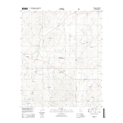
2014 Map of Pinedale
USGS Topo · Published 2014About this map
The Mogollon Plateau and the southern reaches of the Sitgreaves National Forest define the high country landscape of this Navajo County region. Settlement is clustered around the communities of Pinedale, Linden, and Burton, which are connected by a network of ranch and forest roads like Pinedale Rd and State Hwy 260. This map illustrates the vital importance of water management in the arid Arizona uplands, marked by an extensive system of catchments such as Turkey Lake, Mudhole Tank, and the Section Thirty Five Tank. The terrain is deeply incised by drainages like Bull Ranch Draw and Wilson Draw, which descend from prominent landmarks including Juniper Point and the high elevations of Juniper Ridge. These features indicate a history of ranching and forestry where topography dictated the path of travel and the location of local homesteads.
Find a feature on this map
82 named features on this map. Tap any name to fly to it.
Don’t see what you’re looking for? This feature index may not catch every label — zoom into the map to look around manually.
Map Details
Editions of this 2014 Pinedale Map
This is the sole edition of this map. No revisions or reprints were ever made.
Other maps of this area

1886 · Holbrook
USGS Topo · 1:250,000

1893 · Holbrook
USGS Topo · 1:250,000

1954 · Holbrook
USGS Topo · 1:250,000

1957 · Holbrook
USGS Topo · 1:250,000

1958 · Holbrook
USGS Topo · 1:250,000

1960 · Holbrook
USGS Topo · 1:250,000

1961 · Clay Springs
USGS Topo · 1:62,500
1961 · Show Low
USGS Topo · 1:62,500

1961 · Cibecue
USGS Topo · 1:62,500
1970 · Cactus Flat
USGS Topo · 1:24,000