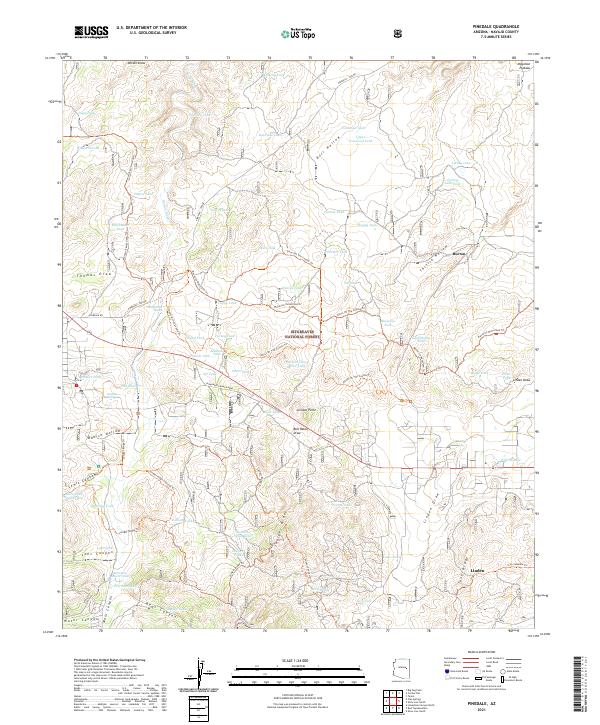
2021 Map of Pinedale
USGS Topo · Published 2021About this map
Sitgreaves National Forest covers much of this high-altitude landscape on the Mogollon Plateau in eastern Arizona. The map highlights a remote ranching and timber environment where water management is paramount, evidenced by a dense network of catchment basins such as Turkey Lake Tank, Bagley Tank, and Henrys Tank. The small communities of Burton and Linden are situated along the eastern edge, connected by local routes like Farnsworth Ranch Road. The terrain is deeply incised by numerous canyons and draws, including Bear Canyon, Danish Hollow, and Thomas Draw. Recreational and ranching travel is defined by named paths such as the Ghost Of The Coyote Trl and the Maverick Motorized Trl, which wind through the timbered ridges and open meadows of the high country.
Find a feature on this map
79 named features on this map. Tap any name to fly to it.
Don’t see what you’re looking for? This feature index may not catch every label — zoom into the map to look around manually.
Map Details
Editions of this 2021 Pinedale Map
This is the sole edition of this map. No revisions or reprints were ever made.
Other maps of this area

1886 · Holbrook
USGS Topo · 1:250,000

1893 · Holbrook
USGS Topo · 1:250,000

1954 · Holbrook
USGS Topo · 1:250,000

1957 · Holbrook
USGS Topo · 1:250,000

1958 · Holbrook
USGS Topo · 1:250,000

1960 · Holbrook
USGS Topo · 1:250,000

1961 · Clay Springs
USGS Topo · 1:62,500
1961 · Show Low
USGS Topo · 1:62,500

1961 · Cibecue
USGS Topo · 1:62,500
1970 · Cactus Flat
USGS Topo · 1:24,000