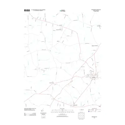
2013 Map of Pinetops
USGS Topo · Published 2013About this map
Pinetops and Macclesfield anchor this portion of the coastal plain, where the landscape is defined by the slow drainage of the Cokey Swamp and the winding course of Town Cr. The mapping reveals a distinct network of crossroads settlements and family-named communities like Saint Lewis, Mercer, and Wiggins Crossroads, many of which developed along the rural road system that connects these small agricultural hubs. The presence of Faith Baptist Church Rd and several named mill branches, including Bynum Mill Cr and Sasnett Mill Br, points to the historical importance of local congregations and water-powered industries in shaping the social and economic geography of the area. This 2013 survey preserves the layout of local connectors such as Temperance Hall Rd and Shallingtons Mill Rd, which trace older paths through the fields and wetlands of Edgecombe County.
Find a feature on this map
115 named features on this map. Tap any name to fly to it.
Don’t see what you’re looking for? This feature index may not catch every label — zoom into the map to look around manually.
Map Details
Editions of this 2013 Pinetops Map
This is the sole edition of this map. No revisions or reprints were ever made.
Other maps of this area

1902 · Rocky Mount
USGS Topo · 1:62,500

1902 · Tarboro
USGS Topo · 1:62,500

1903 · Tarboro
USGS Topo · 1:62,500

1904 · Falkland
USGS Topo · 1:62,500

1904 · Rocky Mount
USGS Topo · 1:62,500

1904 · Wilson
USGS Topo · 1:62,500

1953 · Rocky Mount
USGS Topo · 1:250,000

1954 · Rocky Mount
USGS Topo · 1:250,000
1975 · Rocky Mount
USGS Topo · 1:24,000
1977 · Rocky Mount
USGS Topo · 1:24,000