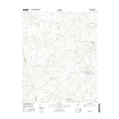
2016 Map of Pinetops
USGS Topo · Published 2016About this map
Pinetops and Macclesfield anchor this portion of the Coastal Plain, where a network of agriculture and local industry is defined by the winding paths of Town Creek and Bynums Mill Run. The landscape is dotted with long-established rural hubs like Saint Lewis, Lancaster, and Wiggins Crossroads, connected by a dense web of farm-to-market roads. Religious and community life is centered at Faith Baptist Church and McKendree Church. The drainage patterns, including Gokey Swamp and Beaverdam Branch, reflect the low-lying topography that has historically shaped the placement of tobacco and cotton fields. Tracing family-named roads such as Martin Sasser Drive and Jenkins Farm Road provides a view into the landownership and genealogy of this part of Edgecombe County.
Find a feature on this map
81 named features on this map. Tap any name to fly to it.
Don’t see what you’re looking for? This feature index may not catch every label — zoom into the map to look around manually.
Map Details
Editions of this 2016 Pinetops Map
This is the sole edition of this map. No revisions or reprints were ever made.
Other maps of this area

1902 · Rocky Mount
USGS Topo · 1:62,500

1902 · Tarboro
USGS Topo · 1:62,500

1903 · Tarboro
USGS Topo · 1:62,500

1904 · Falkland
USGS Topo · 1:62,500

1904 · Rocky Mount
USGS Topo · 1:62,500

1904 · Wilson
USGS Topo · 1:62,500

1953 · Rocky Mount
USGS Topo · 1:250,000

1954 · Rocky Mount
USGS Topo · 1:250,000
1975 · Rocky Mount
USGS Topo · 1:24,000
1977 · Rocky Mount
USGS Topo · 1:24,000