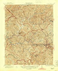
1927 Map of Pineville
USGS Topo · Published 1944About this map
The Guyandot River winds through the heart of this Wyoming County landscape, anchoring a series of isolated river settlements during the mid-1920s. The town of Pineville sits at a critical junction of the river and the Virginian railroad, which follows the steep contours of Barkers Ridge. This era shows a society transitioning from remote mountain hollows to rail-connected commerce, evidenced by the numerous small educational institutions like Baldwin Branch School and Sun Hill School that served these dispersed communities.
Find a feature on this map
71 named features on this map. Tap any name to fly to it.
Don’t see what you’re looking for? This feature index may not catch every label — zoom into the map to look around manually.
Map Details
Editions of this 1927 Pineville Map
2 editions found
Other maps of this area

1887 · Pocahontas
USGS Topo · 1:125,000

1891 · Tazewell
USGS Topo · 1:125,000

1891 · Pocahontas
USGS Topo · 1:125,000

1891 · Oceana
USGS Topo · 1:125,000

1891 · Raleigh
USGS Topo · 1:125,000

1893 · Oceana
USGS Topo · 1:125,000

1894 · Pocahontas
USGS Topo · 1:125,000

1895 · Tazewell
USGS Topo · 1:125,000

1895 · Pocahontas
USGS Topo · 1:125,000

1897 · Tazewell
USGS Topo · 1:125,000