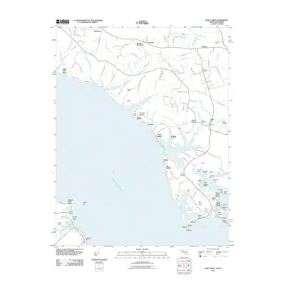
2011 Map of Piney Point
USGS Topo · Published 2011About this map
Piney Point Lighthouse stands as a sentinel at the southern tip of this peninsula, where the Potomac River meets the smaller inlets of Saint Marys County. The landscape is defined by its deep maritime heritage, visible in the cluster of waterfront settlements like Tall Timbers, McKay Beach, and Piney Point. Inland, the area maintains a rural character with large tracts such as Mulberry Fields and Jubilee Farm interspersed among winding creeks like Poplar Hill Creek and Johns Creek.
Find a feature on this map
137 named features on this map. Tap any name to fly to it.
Don’t see what you’re looking for? This feature index may not catch every label — zoom into the map to look around manually.
Map Details
Editions of this 2011 Piney Point Map
This is the sole edition of this map. No revisions or reprints were ever made.
Other maps of this area

1892 · Leonardtown
USGS Topo · 1:62,500

1892 · Drum Point
USGS Topo · 1:62,500

1892 · Piney Point
USGS Topo · 1:62,500

1894 · Piney Point
USGS Topo · 1:62,500

1894 · Point Lookout
USGS Topo · 1:62,500

1895 · Leonardtown
USGS Topo · 1:62,500

1895 · Nomini
USGS Topo · 1:125,000

1895 · Piney Point
USGS Topo · 1:62,500

1898 · Nomini
USGS Topo · 1:125,000

1898 · St. Marys
USGS Topo · 1:125,000