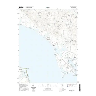
2016 Map of Piney Point
USGS Topo · Published 2016About this map
Piney Point and its adjacent beaches define the coastal landscape of St. Marys County where the Potomac River reaches its widest extent. The 2016 survey illustrates a complex shoreline of points, coves, and bars, from Herring Run Bar to the specialized landings at Tall Timbers and McKay Beach. Inland, the settlement pattern follows historic corridors like Point Lookout Rd, connecting small hubs such as Callaway and Valley Lee. The map provides significant genealogical value, documenting the locations of several burial grounds including Holy Face Cem, Saint Georges Episcopal Cem, and Saint Georges Roman Catholic Cem. The southern tip of the peninsula is characterized by the Saint George Island Bridge and the marshy edges of Piney Point Bar, while the western shore across the Maryland-Virginia boundary shows the development at Ragged Point Beach.
Find a feature on this map
142 named features on this map. Tap any name to fly to it.
Don’t see what you’re looking for? This feature index may not catch every label — zoom into the map to look around manually.
Map Details
Editions of this 2016 Piney Point Map
This is the sole edition of this map. No revisions or reprints were ever made.
Other maps of this area

1892 · Leonardtown
USGS Topo · 1:62,500

1892 · Drum Point
USGS Topo · 1:62,500

1892 · Piney Point
USGS Topo · 1:62,500

1894 · Piney Point
USGS Topo · 1:62,500

1894 · Point Lookout
USGS Topo · 1:62,500

1895 · Leonardtown
USGS Topo · 1:62,500

1895 · Nomini
USGS Topo · 1:125,000

1895 · Piney Point
USGS Topo · 1:62,500

1898 · Nomini
USGS Topo · 1:125,000

1898 · St. Marys
USGS Topo · 1:125,000