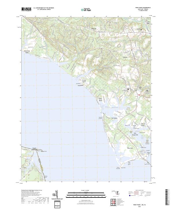
2023 Map of Piney Point
USGS Topo · Published 2023About this map
Piney Point and the surrounding coastline of St. Mary's County reflect a landscape deeply shaped by the Potomac River and Saint Marys River estuaries. This contemporary survey captures the coastal character of the region, from the residential clusters at Tall Timbers and Valley Lee to the more inland settlements of Chingville and Callaway. The map provides significant genealogical value for those researching Southern Maryland families, documenting the Saint Georges Poplar Hill Episcopal Cem and Saint Georges Church Parish Cem.
Find a feature on this map
58 named features on this map. Tap any name to fly to it.
Don’t see what you’re looking for? This feature index may not catch every label — zoom into the map to look around manually.
Map Details
Editions of this 2023 Piney Point Map
This is the sole edition of this map. No revisions or reprints were ever made.
Other maps of this area

1892 · Leonardtown
USGS Topo · 1:62,500

1892 · Drum Point
USGS Topo · 1:62,500

1892 · Piney Point
USGS Topo · 1:62,500

1894 · Piney Point
USGS Topo · 1:62,500

1894 · Point Lookout
USGS Topo · 1:62,500

1895 · Leonardtown
USGS Topo · 1:62,500

1895 · Nomini
USGS Topo · 1:125,000

1895 · Piney Point
USGS Topo · 1:62,500

1898 · Nomini
USGS Topo · 1:125,000

1898 · St. Marys
USGS Topo · 1:125,000