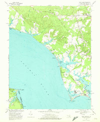
1968 Map of Piney Point
USGS Topo · Published 1972About this map
The Potomac River shoreline of St. Mary's County dominates this late 1960s survey, revealing a landscape defined by deep coves and tidal creeks. Waterfront communities like Tall Timbers and Piney Point are established alongside a mix of agricultural land and maritime infrastructure, including the U S Coast Guard Station and the historic Lighthouse at the southern tip. Inland, the map captures the transition of rural crossroads such as Valley Lee and Callaway, where local life centered around institutions like Holy Face Ch and Little Flower Sch.
Find a feature on this map
76 named features on this map. Tap any name to fly to it.
Don’t see what you’re looking for? This feature index may not catch every label — zoom into the map to look around manually.
Map Details
Editions of this 1968 Piney Point Map
4 editions found
Other maps of this area

1892 · Leonardtown
USGS Topo · 1:62,500

1892 · Drum Point
USGS Topo · 1:62,500

1892 · Piney Point
USGS Topo · 1:62,500

1894 · Piney Point
USGS Topo · 1:62,500

1894 · Point Lookout
USGS Topo · 1:62,500

1895 · Leonardtown
USGS Topo · 1:62,500

1895 · Nomini
USGS Topo · 1:125,000

1895 · Piney Point
USGS Topo · 1:62,500

1898 · Nomini
USGS Topo · 1:125,000

1898 · St. Marys
USGS Topo · 1:125,000