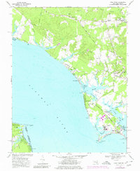
1968 Map of Piney Point
USGS Topo · Published 1980About this map
Piney Point and the surrounding Chesapeake tidewater landscape are defined by the wide expanse of the Potomac River and the intricate network of creeks like St George Creek and Herring Creek. During the late 1960s, this area of St. Mary's County maintained its rural and maritime character, with small settlements like Great Mills and Valley Lee serving as local hubs. The presence of the U S Coast Guard Station and the Piney Point Airport at the tip of the peninsula highlights the strategic importance of this coastal point, while industrial activity is noted by numerous Gravel Pits and a Strip Mine further inland. Social life is centered around local institutions such as Holy Face Ch, St Lukes Ch, and schools like Little Flower Sch. Along the shoreline, recreational spots and beaches such as McKay Beach and Piney Point Beach dot the coast near the St George Island Bridge.
Find a feature on this map
69 named features on this map. Tap any name to fly to it.
Don’t see what you’re looking for? This feature index may not catch every label — zoom into the map to look around manually.
Map Details
Editions of this 1968 Piney Point Map
4 editions found
Other maps of this area

1892 · Leonardtown
USGS Topo · 1:62,500

1892 · Drum Point
USGS Topo · 1:62,500

1892 · Piney Point
USGS Topo · 1:62,500

1894 · Piney Point
USGS Topo · 1:62,500

1894 · Point Lookout
USGS Topo · 1:62,500

1895 · Leonardtown
USGS Topo · 1:62,500

1895 · Nomini
USGS Topo · 1:125,000

1895 · Piney Point
USGS Topo · 1:62,500

1898 · Nomini
USGS Topo · 1:125,000

1898 · St. Marys
USGS Topo · 1:125,000