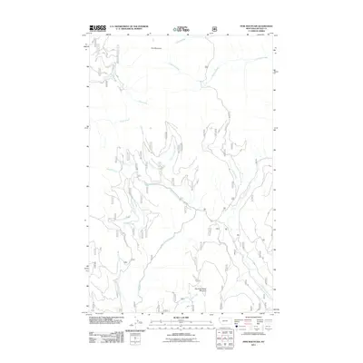
2011 Map of Pink Mountain
USGS Topo · Published 2011About this map
Pink Mountain and Big Creek Baldy Mountain define the high country of Lincoln County in this 2011 survey of the Kootenai National Forest. The landscape is carved by a dense network of drainages, where the East Fork Pipe Creek and South Fork Big Creek serve as primary collectors for numerous mountain streams like Deception Creek, Bearfire Creek, and Weasel Creek. This terrain is accessible via a complex system of timber and forest management routes, including the Zulu Cr Rd and Natl Forest Develop Road 712 Rd. The naming conventions found here—from the ominous Deception Creek to the descriptive Bruin Creek—reflect a wilderness defined by its natural hazards and wildlife, long before modern development altered the mountain reaches.
Find a feature on this map
20 named features on this map. Tap any name to fly to it.
Don’t see what you’re looking for? This feature index may not catch every label — zoom into the map to look around manually.
Map Details
Editions of this 2011 Pink Mountain Map
This is the sole edition of this map. No revisions or reprints were ever made.
Other maps of this area

1957 · Kalispell
USGS Topo · 1:250,000

1960 · Kalispell
USGS Topo · 1:250,000

1961 · Kalispell
USGS Topo · 1:250,000

1963 · Yaak
USGS Topo · 1:24,000

1963 · Turner Mountain
USGS Topo · 1:24,000

1963 · Pink Mountain
USGS Topo · 1:24,000

1963 · Banfield Mountain
USGS Topo · 1:24,000

1963 · Boulder Lakes
USGS Topo · 1:24,000
1963 · Flatiron Mountain
USGS Topo · 1:24,000

1963 · Lost Horse Mountain
USGS Topo · 1:24,000