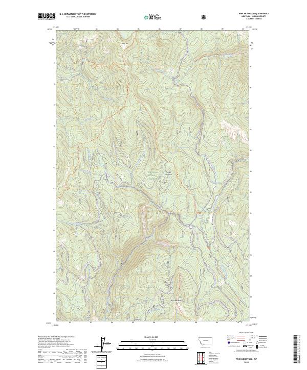
2024 Map of Pink Mountain
USGS Topo · Published 2024About this map
Pink Mountain dominates the high terrain of northwest Montana in this 2024 topographic study. Situated within the Purcell Mountains and managed as part of the Kootenai National Forest, the landscape is defined by a dense network of watercourses including Copeland Creek, Smoot Creek, and the many branches of the South Fork Big Creek. This modern survey illustrates the current management of the wildlands through an extensive system of forest service roads and snowmobile loops, such as the Garden Ridge Snowmobile Loop and Deception Cr Snowmobile Loop. It remains a vital reference for understanding the hydrological patterns of the Basin Cr and Zulu Creek watersheds in a remote corner of Lincoln County.
Find a feature on this map
1 named feature on this map. Tap any name to fly to it.
Don’t see what you’re looking for? This feature index may not catch every label — zoom into the map to look around manually.
Map Details
Editions of this 2024 Pink Mountain Map
This is the sole edition of this map. No revisions or reprints were ever made.
Other maps of this area

1957 · Kalispell
USGS Topo · 1:250,000

1960 · Kalispell
USGS Topo · 1:250,000

1961 · Kalispell
USGS Topo · 1:250,000

1963 · Yaak
USGS Topo · 1:24,000

1963 · Turner Mountain
USGS Topo · 1:24,000

1963 · Pink Mountain
USGS Topo · 1:24,000

1963 · Banfield Mountain
USGS Topo · 1:24,000

1963 · Boulder Lakes
USGS Topo · 1:24,000
1963 · Flatiron Mountain
USGS Topo · 1:24,000

1963 · Lost Horse Mountain
USGS Topo · 1:24,000