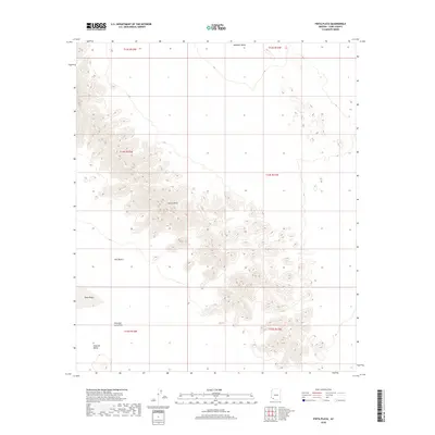
2018 Map of Pinta Playa
USGS Topo · Published 2018About this map
Sierra Pinta dominates this portion of the Sonoran landscape, providing a sharp topographic contrast to the surrounding basins. This 2018 survey documents a region defined by extreme aridity and volcanic history, where the dark expanse of the Pinacate Lava Flow meets the floor of the Pinacate Valley. The map centers on the Pinta Playa, a seasonal dry lakebed that serves as a focal point for the Tule Desert to the west and the southern reaches of the Mohawk Valley to the north. This is a wilderness of profound geological exposure, showing the precise relationship between the jagged uplift of the Sierra Pinta and the low-lying drainage basins that collect infrequent desert runoff. The lack of modern development emphasizes the persistent character of this remote corridor along the Arizona borderlands.
Find a feature on this map
12 named features on this map. Tap any name to fly to it.
Don’t see what you’re looking for? This feature index may not catch every label — zoom into the map to look around manually.
Map Details
Editions of this 2018 Pinta Playa Map
This is the sole edition of this map. No revisions or reprints were ever made.
Other maps of this area

1953 · Ajo
USGS Topo · 1:250,000

1957 · Ajo
USGS Topo · 1:250,000

1958 · Ajo
USGS Topo · 1:250,000

1962 · Ajo
USGS Topo · 1:250,000

1963 · Ajo
USGS Topo · 1:250,000

1965 · O'Neill Hills
USGS Topo · 1:62,500

1965 · Granite Mountains
USGS Topo · 1:62,500

1965 · Isla Pinta
USGS Topo · 1:62,500

1965 · Sierra Arida
USGS Topo · 1:62,500

1967 · Ajo
USGS Topo · 1:250,000