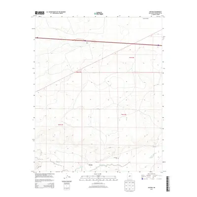
2013 Map of Pintada
USGS Topo · Published 2013About this map
Pintada Arroyo winds through this Guadalupe County landscape, tracing a path south of the small settlements that define the local geography. The map documents the relationship between Pintada and Old Pintada, providing vital details for researchers such as the location of the Old Pintada Cem. The terrain is marked by significant elevation changes, including the Cañon de Baca in the northeast and numerous unnamed mesas and draws. This 2013 survey illustrates a sparsely populated ranching region where large landholdings like York Ranch dominate the northern portion of the quadrangle. Transportation is limited to a few primary arteries, notably Co Road 4 and Pintada Rd, which connect these isolated outposts across the high plains of New Mexico.
Find a feature on this map
12 named features on this map. Tap any name to fly to it.
Don’t see what you’re looking for? This feature index may not catch every label — zoom into the map to look around manually.
Map Details
Editions of this 2013 Pintada Map
This is the sole edition of this map. No revisions or reprints were ever made.
Other maps of this area

1890 · Bernal
USGS Topo · 1:125,000

1891 · Bernal
USGS Topo · 1:125,000

1892 · Corazon
USGS Topo · 1:125,000

1894 · Corazon
USGS Topo · 1:125,000

1894 · Bernal
USGS Topo · 1:125,000

1954 · Santa Fe
USGS Topo · 1:250,000

1954 · Fort Sumner
USGS Topo · 1:250,000

1958 · Fort Sumner
USGS Topo · 1:250,000

1958 · Santa Fe
USGS Topo · 1:250,000
1963 · Thompson Ranch
USGS Topo · 1:24,000