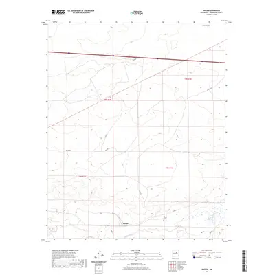
2020 Map of Pintada
USGS Topo · Published 2020About this map
Pintada serves as the focal point of this Guadalupe County landscape, situated near the seasonal drainage of Pintada Arroyo. The settlement's history is anchored by the Old Pintada Cem to the east, providing a point of interest for genealogical research in this part of New Mexico. The terrain is defined by the significant depression of Cañon de Baca in the north, while a network of rural routes such as Milagro Rd and Pintada Rd cross the high plains. The transition between township boundaries t9n r17e and t8n r18e reflects the systematic land divisions of the region, where the road network, including Sunset Rd and Sunrise Rd, follows the natural contours and property lines of the ranching country.
Find a feature on this map
16 named features on this map. Tap any name to fly to it.
Don’t see what you’re looking for? This feature index may not catch every label — zoom into the map to look around manually.
Map Details
Editions of this 2020 Pintada Map
This is the sole edition of this map. No revisions or reprints were ever made.
Other maps of this area

1890 · Bernal
USGS Topo · 1:125,000

1891 · Bernal
USGS Topo · 1:125,000

1892 · Corazon
USGS Topo · 1:125,000

1894 · Corazon
USGS Topo · 1:125,000

1894 · Bernal
USGS Topo · 1:125,000

1954 · Santa Fe
USGS Topo · 1:250,000

1954 · Fort Sumner
USGS Topo · 1:250,000

1958 · Fort Sumner
USGS Topo · 1:250,000

1958 · Santa Fe
USGS Topo · 1:250,000
1963 · Thompson Ranch
USGS Topo · 1:24,000