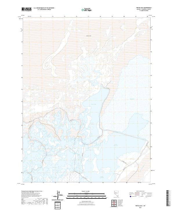
2021 Map of Pintail Bay
USGS Topo · Published 2021About this map
The vast hydrology of the Carson Sink defines this section of Churchill County, where an intricate network of wetlands and shallow basins creates a distinct desert-water landscape. Extensive marshlands including Stillwater Marsh and Swan Lake dominate the southern half of the sheet, connected by a system of dikes and named access points like Willow Dike Rd and Center Rd. The central feature, Pintail Bay, is bordered by the specialized habitat areas of North Nutgrass and West Nutgrass.
Find a feature on this map
27 named features on this map. Tap any name to fly to it.
Don’t see what you’re looking for? This feature index may not catch every label — zoom into the map to look around manually.
Map Details
Editions of this 2021 Pintail Bay Map
This is the sole edition of this map. No revisions or reprints were ever made.
Other maps of this area

1908 · Carson Sink
USGS Topo · 1:250,000

1910 · Carson Sink
USGS Topo · 1:250,000

1950 · Stillwater
USGS Topo · 1:62,500

1951 · Carson Sink
USGS Topo · 1:62,500

1957 · Reno
USGS Topo · 1:250,000

1959 · Reno
USGS Topo · 1:250,000

1960 · Reno
USGS Topo · 1:250,000
1969 · Lone Rock SW
USGS Topo · 1:24,000

1969 · Cox Canyon
USGS Topo · 1:24,000

1969 · Table Mtn
USGS Topo · 1:24,000