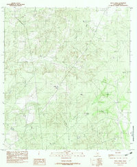
1982 Map of Pinto Creek
USGS Topo · Published 1982About this map
Pinto Creek and Carricitos Creek wind through this part of Webb County, defining a landscape shaped by intermittent water and ranching infrastructure. This 1982 provisional edition, based on earlier mid-1970s field checks, reveals the critical role of artificial water sources in the South Texas brush country. The map identifies numerous stock ponds and water catchments, such as Chapote Tank, Chaga Negro Tank, and Jabon Tank, which are essential for land management in this arid environment. The terrain is marked by the confluence of Espada Cr and Pinto Creek, showing a complex system of drainage and relief. For researchers, these specific named tanks provide localized landmarks in an area otherwise characterized by vast ranching tracts, offering a detailed look at the rural hydrology and land use of the period.
Find a feature on this map
9 named features on this map. Tap any name to fly to it.
Don’t see what you’re looking for? This feature index may not catch every label — zoom into the map to look around manually.
Map Details
Editions of this 1982 Pinto Creek Map
This is the sole edition of this map. No revisions or reprints were ever made.
Other maps of this area

1923 · Palafox
USGS Topo · 1:62,500

1929 · Cotulla
USGS Topo · 1:125,000

1940 · Velenzuela Creek
USGS Topo · 1:62,500

1940 · San Loranzo Creek
USGS Topo · 1:62,500

1953 · Crystal City
USGS Topo · 1:250,000

1955 · Crystal City
USGS Topo · 1:250,000

1956 · Las Tiendas
USGS Topo · 1:62,500

1956 · Laredo
USGS Topo · 1:250,000

1961 · Crystal City
USGS Topo · 1:250,000

1965 · Cerritos Blancos
USGS Topo · 1:24,000