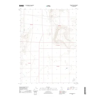
2018 Map of Pinto Mountain
USGS Topo · Published 2018About this map
Geothermal features and arid basins characterize this 2018 survey of the western Nevada high desert. The prominence of Pinto Mtn dominates the central landscape, acting as a topographical anchor near the northern margins of the Black Rock Desert. This area is defined by its thermal activity, specifically at Pinto Hot Springs and West Pinto Hot Spring, which indicate the underlying geologic energy of the region. Water sources in this dry environment are scarce but critical, evidenced by the presence of Battle Cr and Paiute Cr, as well as Sheep Head Spring to the west. The sparse infrastructure of Leonard Creek Rd provides the primary corridor through this remote part of Humboldt County, tracing the edge of the mountains where they meet the expansive desert floor.
Find a feature on this map
13 named features on this map. Tap any name to fly to it.
Don’t see what you’re looking for? This feature index may not catch every label — zoom into the map to look around manually.
Map Details
Editions of this 2018 Pinto Mountain Map
This is the sole edition of this map. No revisions or reprints were ever made.
Other maps of this area

1886 · Disaster
USGS Topo · 1:250,000

1893 · Disaster
USGS Topo · 1:250,000

1954 · Vya
USGS Topo · 1:250,000

1958 · Vya
USGS Topo · 1:250,000

1962 · Vya
USGS Topo · 1:250,000

1966 · King Lear Peak
USGS Topo · 1:62,500

1972 · Pinto Mountain
USGS Topo · 1:24,000

1972 · Burnt Springs
USGS Topo · 1:24,000

1972 · Leonard Cr. Slough North
USGS Topo · 1:24,000
1972 · Battle Creek Ranch
USGS Topo · 1:24,000