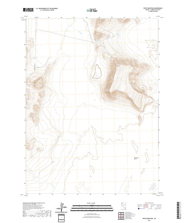
2021 Map of Pinto Mountain
USGS Topo · Published 2021About this map
Pinto Hot Springs and the nearby West Pinto Hot Spring emerge from the high desert floor at the foot of Pinto Mtn, creating a localized thermal landscape within the vast northern reaches of the Black Rock Desert. This 2021 survey illustrates a region where water sources dictate the geography, from the isolated Sheep Head Spring to the seasonal courses of Battle Cr and Paiute Cr. The presence of these reliable water points in such an arid environment suggests their historical importance for travelers and livestock long before modern surveying. Infrastructure is sparse, primarily defined by the transit corridor of Leonard Creek Rd, which serves as the primary artery through this section of Humboldt County. The map provides a precise look at the township and range system, showing the surveyed sections that organize this open terrain.
Find a feature on this map
13 named features on this map. Tap any name to fly to it.
Don’t see what you’re looking for? This feature index may not catch every label — zoom into the map to look around manually.
Map Details
Editions of this 2021 Pinto Mountain Map
This is the sole edition of this map. No revisions or reprints were ever made.
Other maps of this area

1886 · Disaster
USGS Topo · 1:250,000

1893 · Disaster
USGS Topo · 1:250,000

1954 · Vya
USGS Topo · 1:250,000

1958 · Vya
USGS Topo · 1:250,000

1962 · Vya
USGS Topo · 1:250,000

1966 · King Lear Peak
USGS Topo · 1:62,500

1972 · Pinto Mountain
USGS Topo · 1:24,000

1972 · Burnt Springs
USGS Topo · 1:24,000

1972 · Leonard Cr. Slough North
USGS Topo · 1:24,000
1972 · Battle Creek Ranch
USGS Topo · 1:24,000