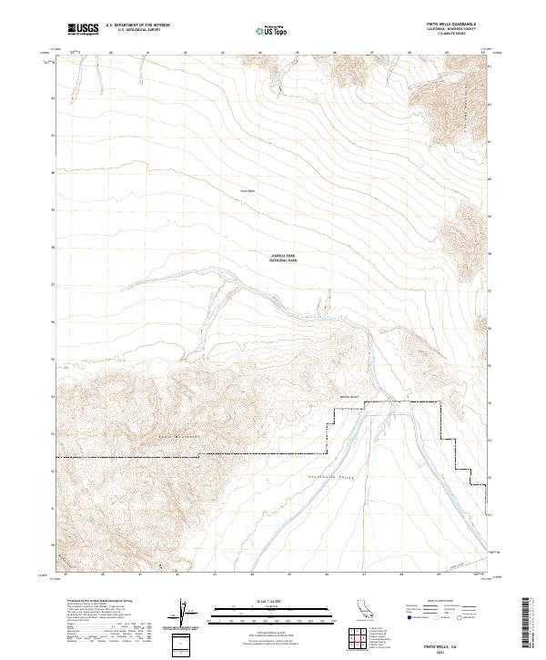
2021 Map of Pinto Wells
USGS Topo · Published 2021About this map
Joshua Tree National Park encompasses much of this desert terrain, where the low-lying Pinto Basin meets the dramatic rises of the Coxcomb Mountains and Eagle Mountains. This 2021 survey illustrates the modern intersection of natural preservation and critical infrastructure, most notably the path of the Colorado River Aqueduct as it traverses the southern portion of the quadrangle. The hydrology is dominated by the seasonal Pinto Wash, which drains through the heart of the park toward the Mojave Desert and Chuckwalla Valley. In the southwest corner, the landscape grows increasingly complex near Bold Eagle Canyon. The presence of Phone Line Rd along the southern margin represents one of the few human-engineered routes through this otherwise protected wilderness area, highlighting the sparse, managed accessibility typical of this part of Riverside County.
Find a feature on this map
14 named features on this map. Tap any name to fly to it.
Don’t see what you’re looking for? This feature index may not catch every label — zoom into the map to look around manually.
Map Details
Editions of this 2021 Pinto Wells Map
This is the sole edition of this map. No revisions or reprints were ever made.
Other maps of this area

1942 · Amboy
USGS Topo · 1:250,000

1943 · Amboy
USGS Topo · 1:250,000

1943 · Cadiz Valley
USGS Topo · 1:62,500

1943 · Coxcomb Mountains
USGS Topo · 1:62,500

1944 · Eagle Tank
USGS Topo · 1:62,500

1944 · Coxcomb Mountains
USGS Topo · 1:62,500

1954 · Salton Sea
USGS Topo · 1:250,000

1954 · Needles
USGS Topo · 1:250,000

1955 · Salton Sea
USGS Topo · 1:250,000

1956 · Needles
USGS Topo · 1:250,000