2022 Map of Piqua
USGS Topo · Published 2022About this map
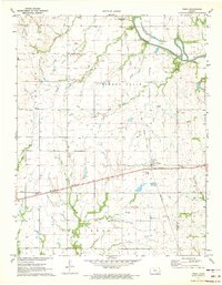
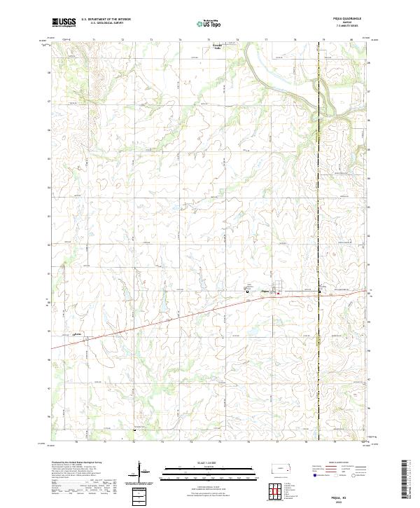
Piqua sits at the heart of this agricultural landscape in eastern Kansas, positioned near the border of Woodson and Allen Counties. The terrain is defined by the winding course of the Neosho River in the northeast, which is fed by several tributaries including Rock Creek and Indian Creek. This region, characterized by a grid-like network of rural roads such as Turkey Road and Xylan Road, preserves a legacy of early Kansas settlement. Local history and genealogy are anchored by several community landmarks, including Saint Martin's Cemetery near Piqua and the Iola Township Cemetery to the east. To the south, the landscape is drained by Bloody Run and Onion Creek, while the northwestern corner shows the outskirts of Neosho Falls and the small locality of Athens. The map illustrates a rural economy structured around section lines and small creek-side settlements.
Find a feature on this map
49 named features on this map. Tap any name to fly to it.
Don’t see what you’re looking for? This feature index may not catch every label — zoom into the map to look around manually.
Map Details
Editions of this 2022 Piqua Map
This is the sole edition of this map. No revisions or reprints were ever made.