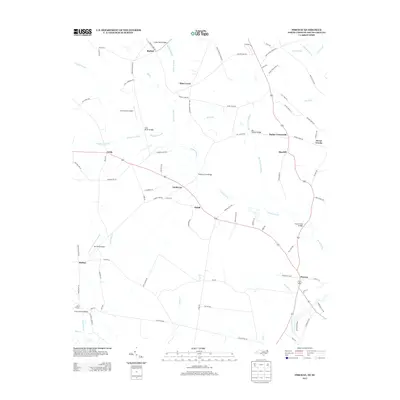
2013 Map of Pireway
USGS Topo · Published 2013About this map
Bethel and Pine Level anchor the northern reaches of this coastal plain landscape, where the geography is defined by an intricate network of wetlands and drainage basins. The area is dominated by the sprawling Grissett Swamp, which stretches across the center of the quadrangle, and the Big Cypress Swamp, necessitating numerous crossings such as the Ramsey Ford Bridges and Cane Break Bridges. Settlement patterns follow the higher ground between these waterways, forming small communities like Guideway, Dulah, and Butler Crossroads.
Find a feature on this map
95 named features on this map. Tap any name to fly to it.
Don’t see what you’re looking for? This feature index may not catch every label — zoom into the map to look around manually.
Map Details
Editions of this 2013 Pireway Map
This is the sole edition of this map. No revisions or reprints were ever made.
Other maps of this area

1937 · Nixonville
USGS Topo · 1:48,000

1942 · Nixonville
USGS Topo · 1:62,500

1943 · Pireway
USGS Topo · 1:31,680

1943 · Nakina
USGS Topo · 1:24,000

1943 · Calabash
USGS Topo · 1:31,680

1943 · Freeland
USGS Topo · 1:24,000

1944 · Longs
USGS Topo · 1:31,680

1949 · Georgetown
USGS Topo · 1:250,000

1953 · Longs
USGS Topo · 1:24,000
1953 · Calabash
USGS Topo · 1:24,000