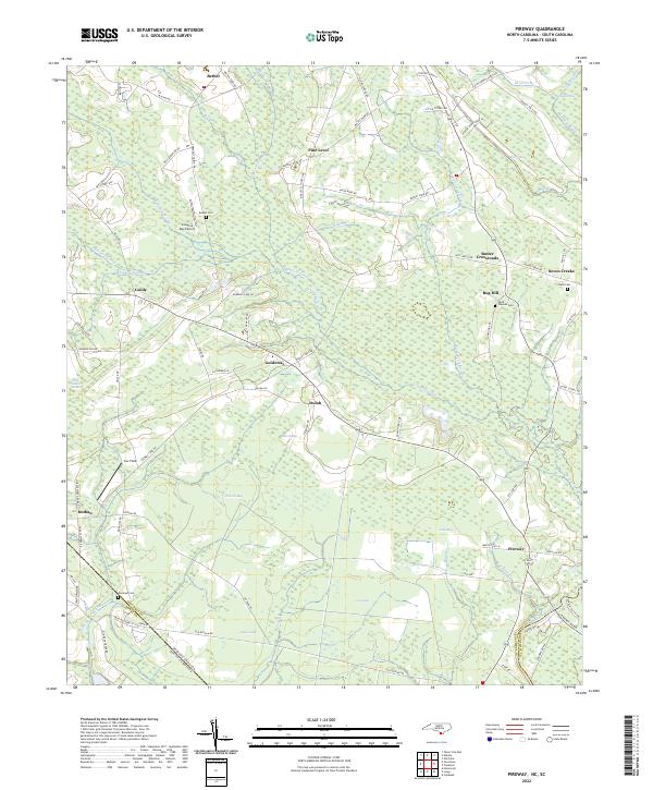
2022 Map of Pireway
USGS Topo · Published 2022About this map
Big Cypress Swamp and Grissett Swamp dominate this low-lying landscape along the border of North and South Carolina. The region is characterized by numerous elliptical depressions known as Carolina Bays, including Jenrette Bay, Club Bay, and Cross Bay. These unique geological features define the local geography, often utilized for small airfields like Carolina Bay Airport or remaining as undeveloped wetlands.
Find a feature on this map
105 named features on this map. Tap any name to fly to it.
Don’t see what you’re looking for? This feature index may not catch every label — zoom into the map to look around manually.
Map Details
Editions of this 2022 Pireway Map
This is the sole edition of this map. No revisions or reprints were ever made.
Other maps of this area

1937 · Nixonville
USGS Topo · 1:48,000

1942 · Nixonville
USGS Topo · 1:62,500

1943 · Pireway
USGS Topo · 1:31,680

1943 · Nakina
USGS Topo · 1:24,000

1943 · Calabash
USGS Topo · 1:31,680

1943 · Freeland
USGS Topo · 1:24,000

1944 · Longs
USGS Topo · 1:31,680

1949 · Georgetown
USGS Topo · 1:250,000

1953 · Longs
USGS Topo · 1:24,000
1953 · Calabash
USGS Topo · 1:24,000